By Kenyon Jordan, Editor
Intrinsic to our proposal - unlike those of the Colorado Department of Transportation (CDOT) - is that the first priority in any expansion should be the preservation of existing Westside character. In keeping with that, our proposal would improve Westside Highway 24 without relocating any existing homes or businesses.
A key part of our plan is to make use of the vacant property just south of Highway 24 between 8th and 21st streets.
This property is Gold Hill Mesa, a mostly unbuilt dev-elopment which is planned for 1,000 or more homes and numerous businesses. Our point is, if land must be taken to absorb increasing traffic, why tear out existing structures when you can make use of vacant land on a future subdivision that is a principal contributor to the traffic projections that spurred CDOT's highway-expansion call in the first place?
The state's proposals only touch the edges of this 214-acre parcel. But it seems plain that a four-lane collector road through Gold Hill Mesa to a new highway interchange at 14th Street would divert thousands of cars - subdivision residents as well as those going to southwest Colorado Springs - from the 21st Street intersection every day. This in turn would eliminate the need for the ungainly full interchange that CDOT has proposed for 21st. We say “ungainly” because CDOT, required by law to avoid Van Briggle Pottery's historic building, proposes swinging the intersection north (wiping out Angler's Covey, the Prospector statue/park and Naegele Road and its businesses) or south (wiping out businesses and homes off Bott Avenue nearly to 23rd Street).
The four-lane Gold Hill Mesa collector could connect to 21st at Broadway Street, where City Traffic Engineering has previously announced plans for a signalized intersection (the light at Bott would go away). This could allow a double-left onto southbound 21st Street. Note: A traffic-calming effort is underway on Broadway west of 21st Street; motorists could be advised of this fact through signs, berms, street narrowing to two lanes, landscaping, etc.
As for 21st, the city has already slated it for an eventual widening to four lanes from Lower Gold Camp Road down to Highway 24, so this intersection should be able to move a great many cars.
What about the impact of an interchange at 14th Street? Ideally, the highway could be lowered there to avoid off-ramps high in the air so close to a residential area. If that's not possible - because of creek proximity or whatever - then CDOT should bend the interchange farther south onto the vacant Gold Hill Mesa property, possibly nestling it into the eroded slopes there to give it style.
Such an interchange could also relieve pressure on the intersection of Eighth Street and 24. CDOT has already suggested something along those lines in its alternative titled “I-25 Direct 8th Overpass/13th Diamond.” We like the state's idea of sending traffic flow south and east around the A-1 Mobile Village and connecting with Garner Street east to Eighth. The reason we propose 14th Street instead of 13th is because there already is a right of way through to the highway at 14th. As a result, no structures would have to be removed to make room for it - unlike the state alternatives that suggest 10th, 13th, 15th or 18th streets.
Remember, too, that while construction has started on Gold Hill Mesa's upper areas (off Lower Gold Camp Road), only conceptual plans have been approved for the development's lower areas (just south of Highway 24), so that area is a year at least from having anything being built on it. In fact, Gold Hill development leader Bob Willard has gone on record saying he was leaving the northwest area of the subdivision - including part of the area for our proposed collector road - unfinalized until the state settled on a highway plan. In any case, it's easier, and far less painful, to relocate homes and businesses on an architect's drafting table than with moving equipment.
Out of consideration for Gold Hill's ownership, the state should provide compensation for this road, or any other land the development's investors would need to give up to make the highway work. Even at fair price, this should not be overly expensive, and the subdivision would also share in the benefit.
As for CDOT's other highway-expansion options, the Pioneer believes that they range between unnecessary to intrusive, representing a continued lack of true caring for the Westside. We say “continued” because the state has allowed numerous dangerous egress situations to remain for decades and, even now, makes no promises of fixing those during the 10 or more years that likely would pass before the slow-grinding wheels of bureaucracy provide funding for the grandiose plans it has been marketing to the public this winter.
The bulleted topics below focus chiefly on the work that could be done - and in some cases should be done immediately - for purposes of safety and traffic flow.
-
 I-25 to Eighth Street: It seems exciting, at first glance, to have a major interchange at Eighth Street, as CDOT proposes, with arching
flyovers from I-25 that
would give Highway 24 motorists the option of bypassing the Eighth Street intersection. But on closer consideration, that configuration comes
across as oversized and
potentially confusing, with the additional downside of wiping out businesses on both the north and south sides of the street.
I-25 to Eighth Street: It seems exciting, at first glance, to have a major interchange at Eighth Street, as CDOT proposes, with arching
flyovers from I-25 that
would give Highway 24 motorists the option of bypassing the Eighth Street intersection. But on closer consideration, that configuration comes
across as oversized and
potentially confusing, with the additional downside of wiping out businesses on both the north and south sides of the street.
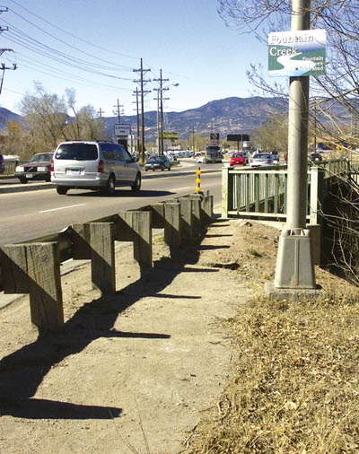
Here is the simple solution. Both east and west now have two through lanes. To help with the traffic load, create a third lane in either direction - one going to and the other coming from the interchange. There appears to be room to do this without impacting any developed private property. The only change needed is to replace the aging Highway 24 bridge over Fountain Creek, which only is wide enough for four lanes.
This work, along with an improved I-25/Cimarron interchange (as defined in CDOT's 2004 Environmental Assessment), should allow this segment to handle the traffic flow, even if the state prediction of a nearly doubled traffic increase in that segment by 2030 comes true.
Safety improvements are needed - now, actually - where northbound Eighth Street vehicles turn right (east) onto Highway 24 and where eastbound vehicles turn right (south) onto Eighth Street. The acceleration lanes in both places are almost non-existent, and vehicles often have to come to a dead stop, then accelerate quickly to merge into traffic.
Note: To handle backups at the northbound right turn onto the highway, the city has scheduled a project this spring to extend the lane leading up to it.
For pedestrians, install an overpass at or near the intersection. This would not only aid mobility for the elderly, handicapped or very young, but would allow ready access north of the intersection to the Midland Trail and, south of the intersection, to the designated bike lane on South Eighth Street and the Bear Creek Regional Park trail near Wal-Mart.
-
 8th to 14th: Retain the two through lanes each way, plus a third lane to and from the interchange. The third lane westbound would start
at the right turn onto
the highway and become a right-turn-only at the 14th Street interchange; the third lane eastbound would start at the interchange and turn right at
Eighth.
8th to 14th: Retain the two through lanes each way, plus a third lane to and from the interchange. The third lane westbound would start
at the right turn onto
the highway and become a right-turn-only at the 14th Street interchange; the third lane eastbound would start at the interchange and turn right at
Eighth.
On the 14th Street part of the overpass/underpass, be sure to have bike lanes and sidewalks on either side. Oh, yes, and a stoplight should go in at 14th and Colorado to accommodate (unlike now) westbound motorists who have turned north (right) from the highway.
-
 14th to 21st: Keep the current two through lanes each way. Additional lanes west of the 14th Street interchange would not be needed
because much of the
local traffic (particularly Gold Hill Mesa's) would be getting on or off at 14th.
14th to 21st: Keep the current two through lanes each way. Additional lanes west of the 14th Street interchange would not be needed
because much of the
local traffic (particularly Gold Hill Mesa's) would be getting on or off at 14th.
Replace the highway's bridge over Fountain Creek a few hundred feet east of the 21st intersection. This has been previously recommended by city and state engineers for safety reasons, but a new bridge could be customized to allow for a trail following the creek underneath. Gold Hill Mesa plans have shown a trail along the creek through its property, and the development last year of Angler's Covey allowed for a trail along the creek north of the bridge. Such a trail connection would provide a pleasant, non-motorized link between Gold Hill Mesa and the older Westside, including the nearby Midland Trail.
-
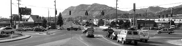
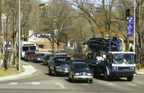
 21st Street intersection: To accommodate potential traffic surges, especially with summer tourists, a double left-turn lane should be
provided in each
direction (except for eastbound traffic turning north). The intersection would have to be widened about a dozen feet for this purpose. Room
could be found by taking
a slice of the flat, grassy area in front of the Prospector statue at the northwest corner - although the idea hurts - and paving some of the unused
land at the southeast
corner near Advance Auto Parts. Why not a double-left for eastbounders going north? Because that would only encourage the commuters from
Ute Pass who are
forever looking for Westside shortcuts to get to their jobs in northeast Colorado Springs or Denver.
21st Street intersection: To accommodate potential traffic surges, especially with summer tourists, a double left-turn lane should be
provided in each
direction (except for eastbound traffic turning north). The intersection would have to be widened about a dozen feet for this purpose. Room
could be found by taking
a slice of the flat, grassy area in front of the Prospector statue at the northwest corner - although the idea hurts - and paving some of the unused
land at the southeast
corner near Advance Auto Parts. Why not a double-left for eastbounders going north? Because that would only encourage the commuters from
Ute Pass who are
forever looking for Westside shortcuts to get to their jobs in northeast Colorado Springs or Denver.
Lengthen the acceleration lanes for traffic turning right onto the highway to go east on 24. Such motorists frequently have to come to a complete stop while waiting for an opening; this creates a doubly dangerous situation by backing up traffic on northbound 21st.
Note: Part of the bottleneck that occurs north of this intersection is due to the narrowness of the bridge over Fountain Creek - cars can't get through to turn right, and the left-turn lane is too short. Replacement of this bridge is listed as one of 24 “critical” projects to be paid for by the city's recently approved Stormwater Enterprise Fund.
-
 26th Street intersection: Lengthen acceleration lanes for vehicles turning right (east as well as west) onto Highway 24. Both currently
have dramatically short
and unsafe run-ups. What puzzles many people is why the eastbound acceleration-lane issue wasn't addressed about five years ago when the
curb there was redone
for the then-new Checker Auto Parts store.
26th Street intersection: Lengthen acceleration lanes for vehicles turning right (east as well as west) onto Highway 24. Both currently
have dramatically short
and unsafe run-ups. What puzzles many people is why the eastbound acceleration-lane issue wasn't addressed about five years ago when the
curb there was redone
for the then-new Checker Auto Parts store.
Widen 26th Street about 10 feet in either direction, at least 100 feet back from the intersection, for a right-turn lane and a longer left-turn lane. There is room on the Checker Auto side and, north of the intersection, the Vermijo Park side. Although it gets comparatively little traffic, 26th can back up because of its narrowness. In conjunction with this widening, the street's bridge over Fountain Creek (just north of the intersection), which now only allows two vehicles at a time, should be replaced with one broad enough for four.
At 25th Street, install a pedestrian overpass. The 26th Street green is often so short that only the agile can make it across in time. An overpass at 25th - where many brave (foolish) people currently cut across - would provide a neighborly connection between the Midland area and Old Colorado City for families, children, the elderly and handicapped individuals.
- 31st Street intersection: Here is yet another place where both the eastbound and westbound acceleration lanes for right-turners
onto Highway 24 are
woefully short and should have been lengthened years ago. The westbound accel lane looks long, but it goes uphill, so many vehicles are
unable to attain highway
speed before the lane ends.
Resist the temptation to put in a double left-turn lane for eastbound motorists wanting to go north on 31st - even if cars do stack up at that light. The last thing we need there is to make it easy for even more vehicles to cruise up 31st Street to Fontanero Street as part of their cut-throughs to I-25.
Also resist the temptation to relocate this intersection to 30th Street (as CDOT proposes in one of its alternatives). This change may look good on paper, creating a straight shot up to the Garden of the Gods, but would unnecessarily remove homes and businesses and accomplish no more than to move the 31st Street commuter- traffic problem one block east.
Between the highway and Colorado Avenue, widen 31st to accommodate a third lane for right-turns onto eastbound Colorado Avenue or westbound Highway 24. This is another place where unnecessary back-ups occur. It's also another example of recent work having been done (when the new Taco Bell went in a few years ago) and traffic engineers not gauging the extent of the right-turn problem.
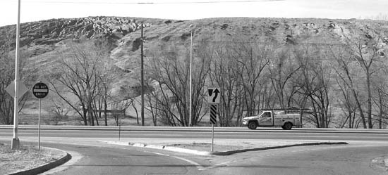
- Ridge Road/ High Street intersection: A stoplight may be installed at this dangerous crossing within the year - a separate office of
CDOT has agreed to
study traffic counts and other factors this summer - but the Ridge Road traffic is scanty enough that the intersection seems to be a good
candidate for a low-impact,
rural-style, grade-separated crossing. For example, picture westbound vehicles getting off there via a long right-hand deceleration lane, stopping
at a stop sign, then
turning left under the highway to access Red Rock Canyon Open Space. Easy and safe. Why an underpass? Less visual impact and, according
to wildlife lovers, a
less dangerous way for deer to traverse the highway (assuming they can read the signs!).
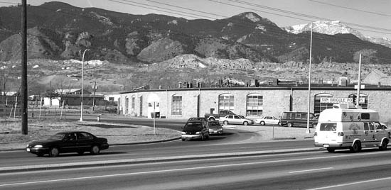
- Manitou Springs interchange: What was CDOT thinking? Its various alternatives for redoing this interchange would tear out
businesses and provide no
improvement to traffic flow. While it may not meet modern off-ramp/on-ramp standards, the current Manitou interchange never backs up and
handles its relatively low
amount of traffic efficiently. The only possible safety enhancement we'd recommend is a longer acceleration lane for the uphill westbound traffic.
- General: Landscaping is a must. The 5-foot-high weeds all along Westside Highway 24 should be replaced with attractive shrubs
and trees. The
median appears too narrow for plantings, but surely some type of attractive divider style could be found in a traffic engineering catalog.
No sound walls. Plant trees strategically and take care of them...
Westside Pioneer article